 easy
easy | ↔ 21km | ↗ 580m | ↘ 580m | 🕑 6 hours | easy |
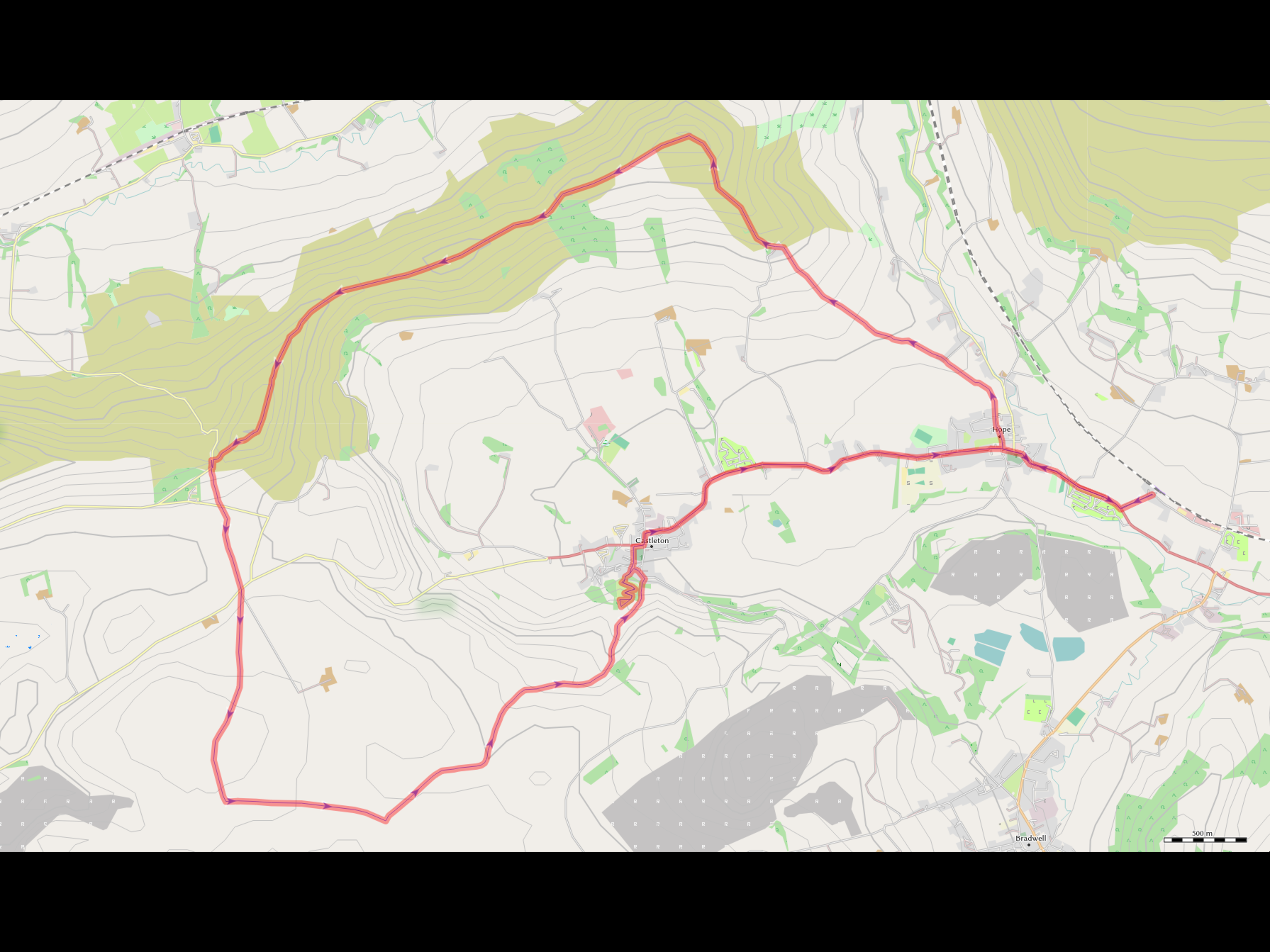
A round walk around the Hope Valley with a small visit to an 11th century castle. The first part takes you through pastures to the hills. This is followed by a walk on the ridge leading to Mom Tor, the highest point of the hike. After descending, a nother walk through some meadows brings you to a passage thorugh a small canyon, which is flanked by the caslte. Having left the canyon, a visit to the castle and the subsequent return finish of the trip.
Waking up a little bit late around 7 in the morning I packed my stuff, made two bowles of joghurt with oats and headed for the Oxford Road train station. On the way I grabed a cup of coffee and some sandwhich and then waited for the train. Some of the connections got cancled as there seems to be a shortage of train staff, but the trains not canceled where perfectly on time, although a little bit aged. After an almost two hour train ride, first through the city and then its outskirts, later through the national park, I arrived at the train station of Hope, a small village with a hefty name. Stepping out of the train, accompanied by around 50 other people, I already got slightly worried about the amount of hikers. Crossing the traintracks on a small wooden bridge with metal reinfrocements, I set to to the village of hope itself, which is around 1km down a main road.
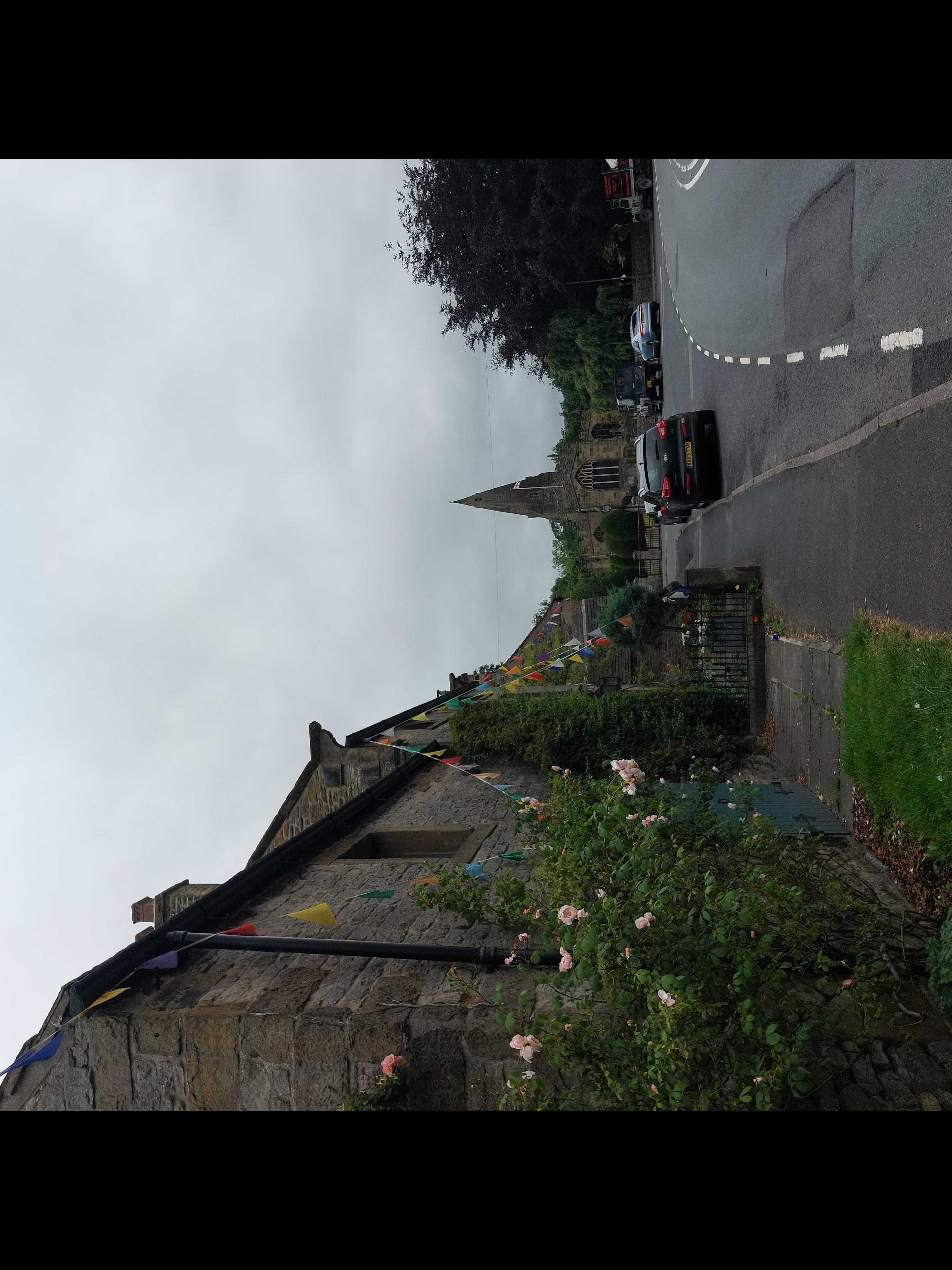
Hope itself ticks a lot of points on the english-cliche list with its small stone houses, the land rovers on the street, the church with the graveyard around it. I got some flashbacks to the series of the “Fünf Freunde” by Enid Blyton I read as a child. But you also see how touristic this area is, the local economy seems to be made up out of bed and breakfasts, hiking gear shops and pubs.
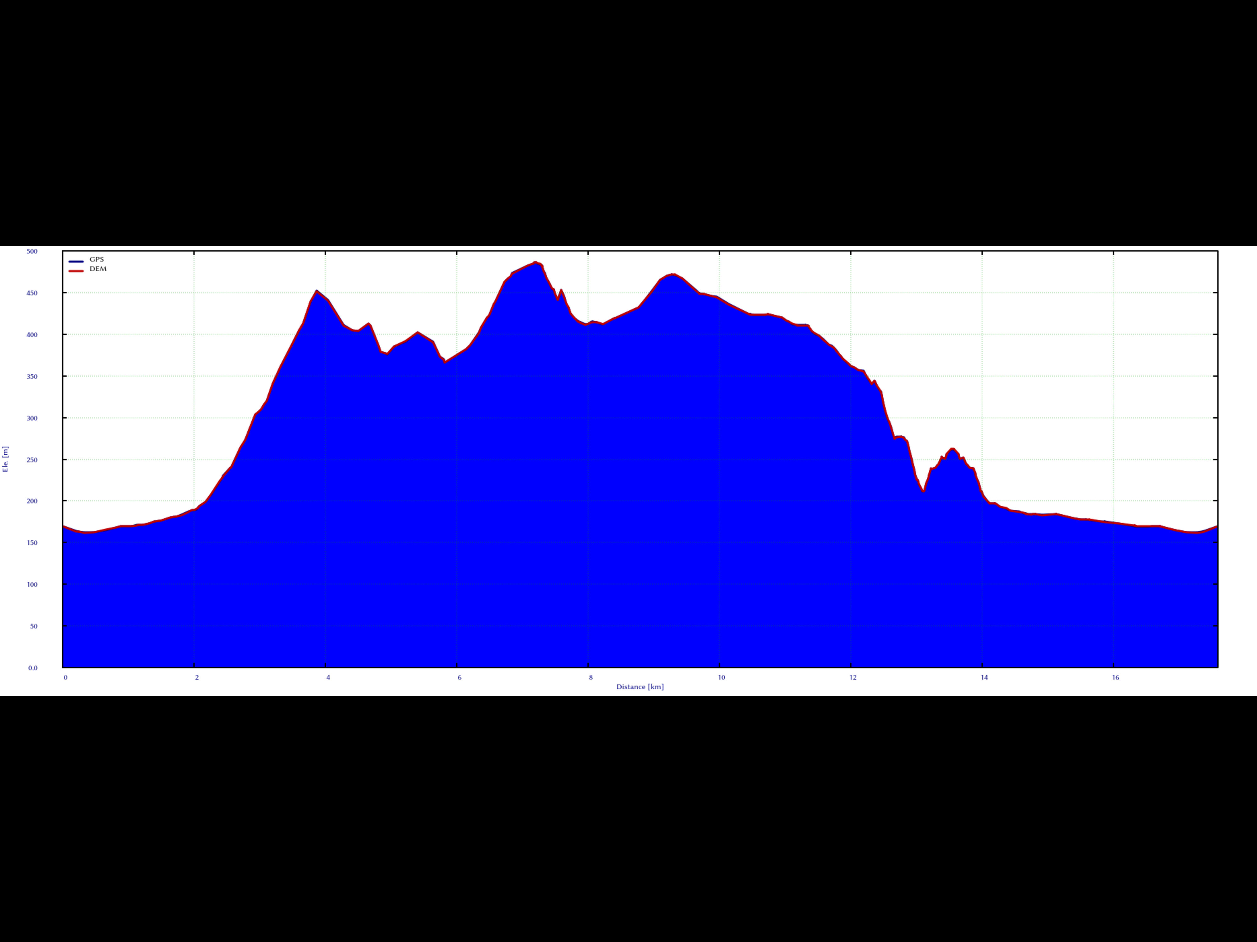
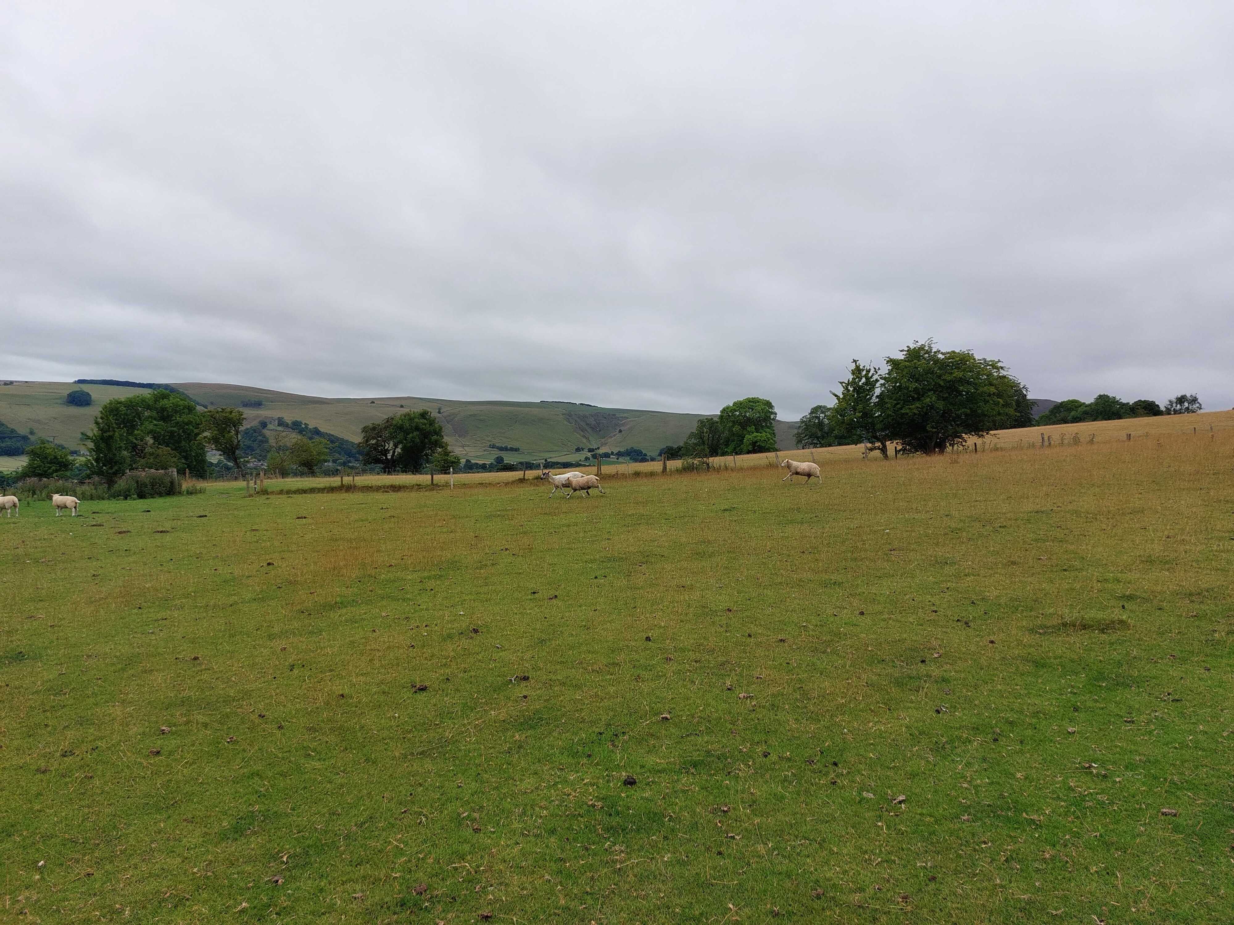
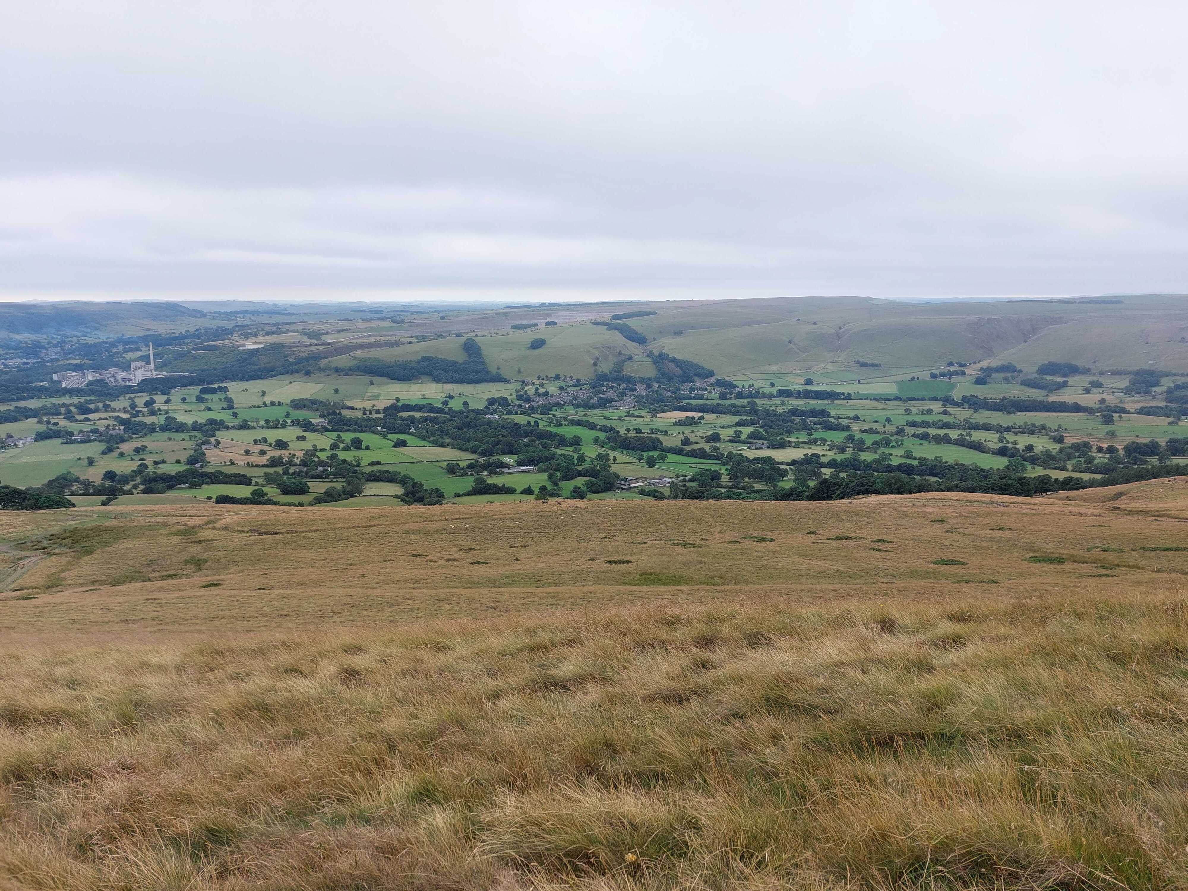
Leaving hope for a calm hike behind, I followed a small foot path leading through some houses and backyards to the base of the first hill of the day. Until you arrive at the base of the hill, you have to walk through a lot of green patches of land, seamed with dry rock walls and populated by sheep. A mixture that follows you all over the region. The incline to the Lose Hill is the heaviest one, afterwards you mostly walk on the ridge. Having arrived on the top, a small walk takes you along the ridge to the Black Tor, a second hill with a really nice overview to the north of Hope Valley.
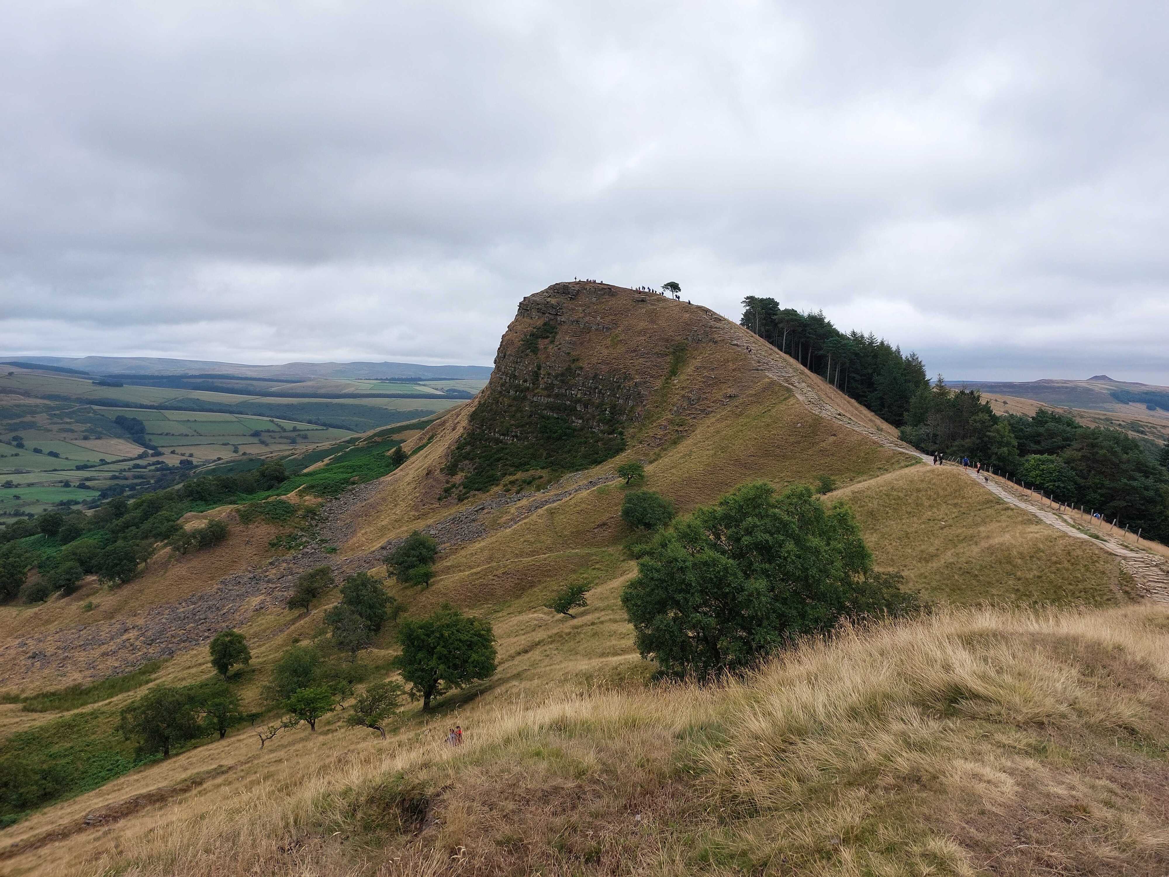
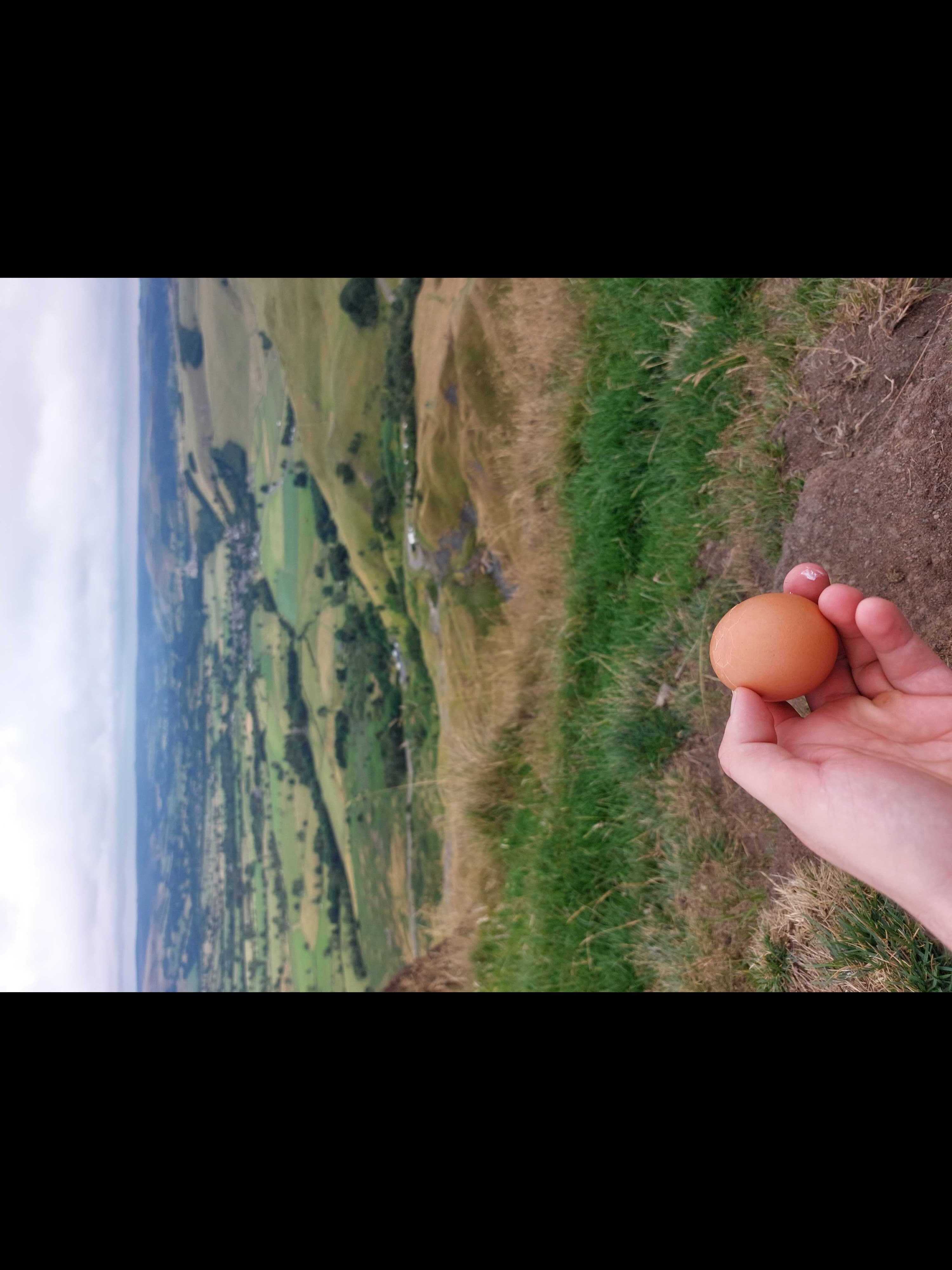
Afterwords you again follow a foot path up to the highest point, called Mam Tor, which allows you to view down into Hope Valley in the south. Here is where I took a break, ate the required Gipfel-egg and went on, as the top was crowded by around 150 people.
Following a small decent along, what essentially was a stair, I meet an older British couple. He was an retired solider, who was constantly talking about the things he learned in the army, how different maps are and should be used and so on. Both of them were quite fit for their age and we walked around 3 kilometers together, chatting about this and that. They taught me the word Fell, which describes the kind of Hills we see around Hope Valley.
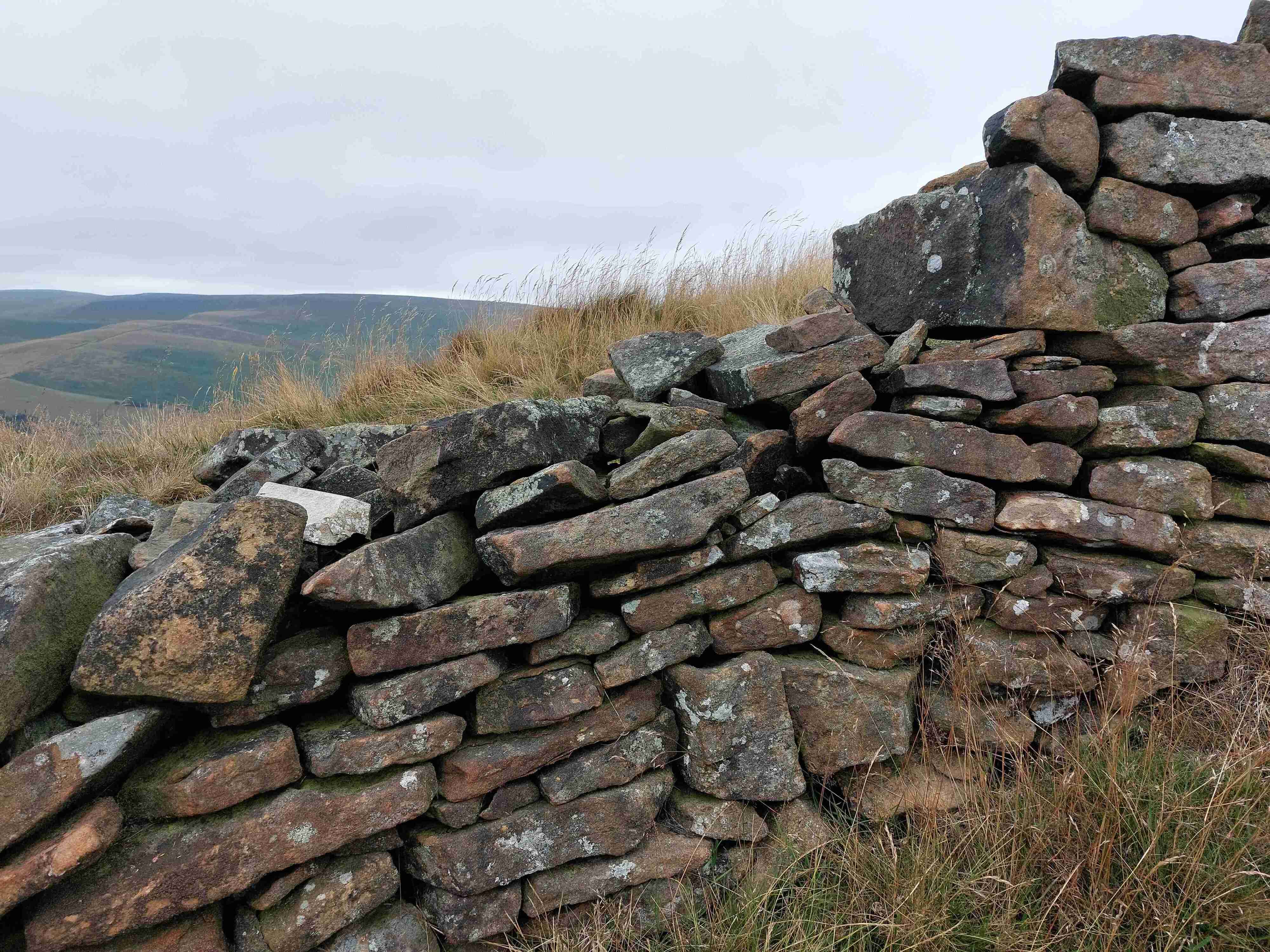
We departed at a cross-road, where they where heading to Castleston. As I was following them on their track, I came away from my original planed path. So I wanted to find back to the original path, but turned the wrong direction at some point, which lead my heading through some sheep filled plots of land. After around 1km in to this specific field, I realised that it had no proper exit in the direction I thought I had to go, so I had to climb over the dry stone wall, secured with a ton of barbed wire. The good old jacket trick helped and on the other side, I then kind of come to terms that I was on the wrong track. But instead of going back, I continued walking in the same direction as I saw a track on the map, that joined my originally planed route later on. So, after a few more stone wall crossings and once not realising I am already on the track, I needed to be on, I finally arrived at the path I was aiming for. The GPX data linked here are the one for the proper planed hike.
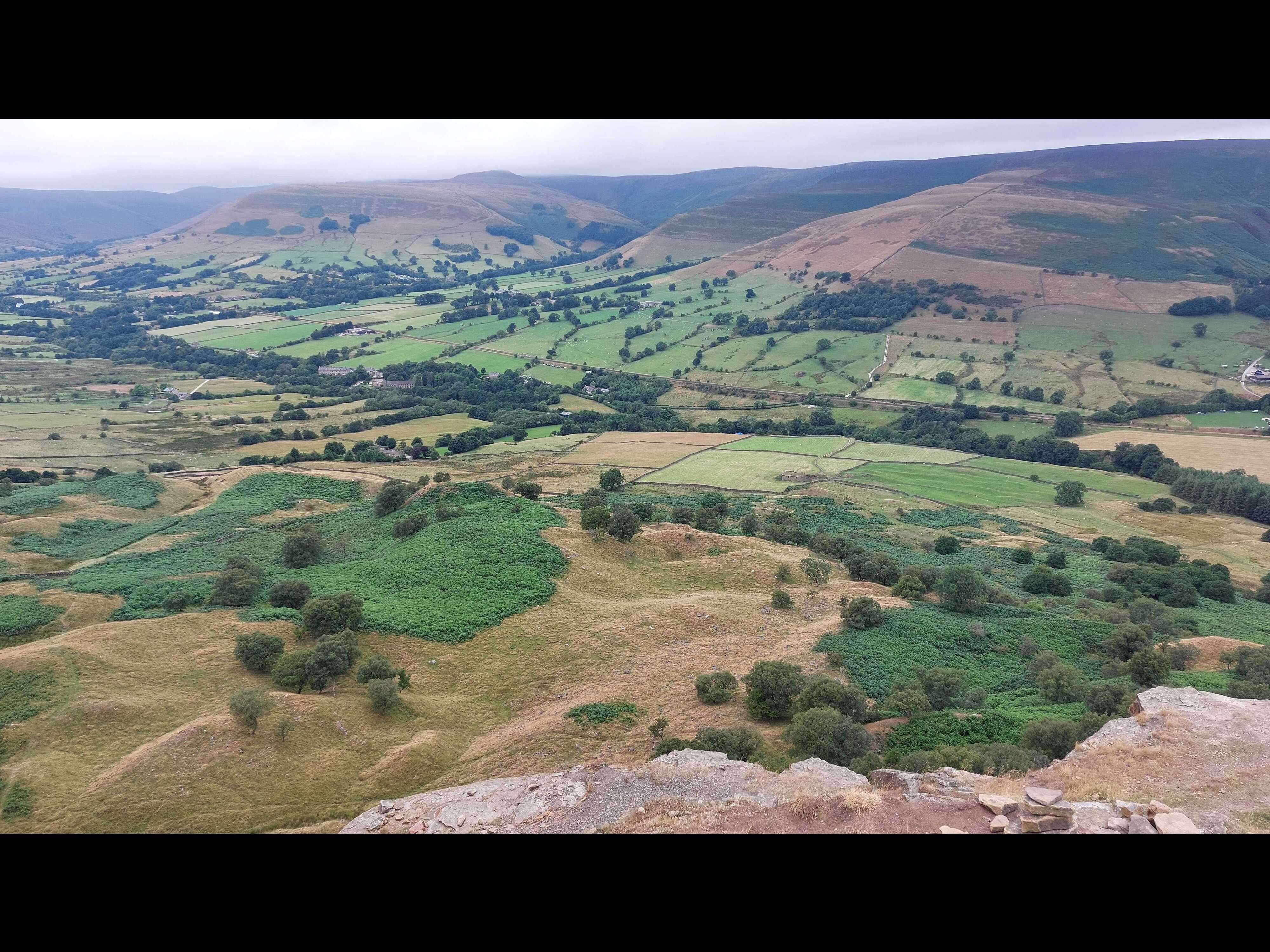
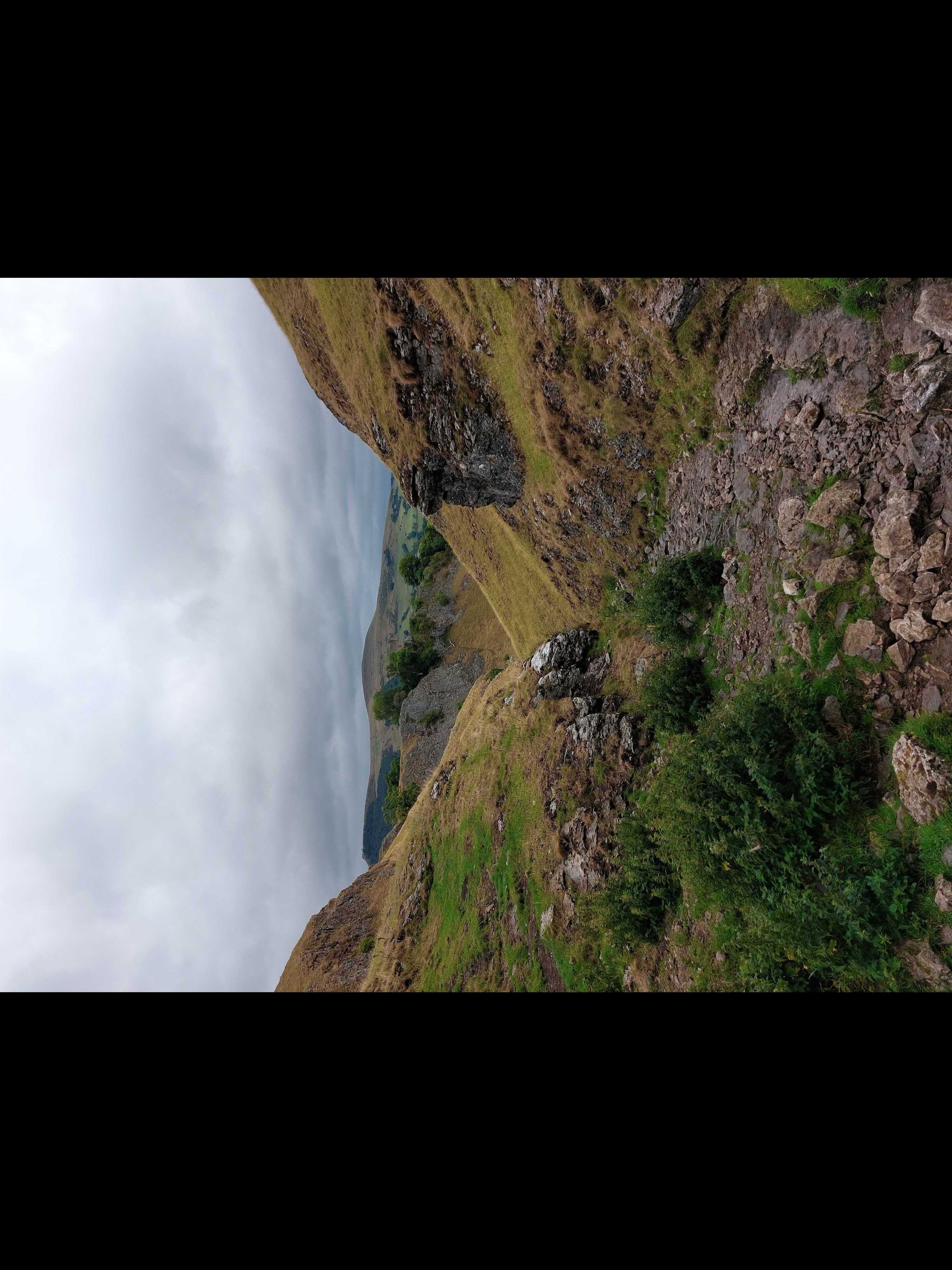
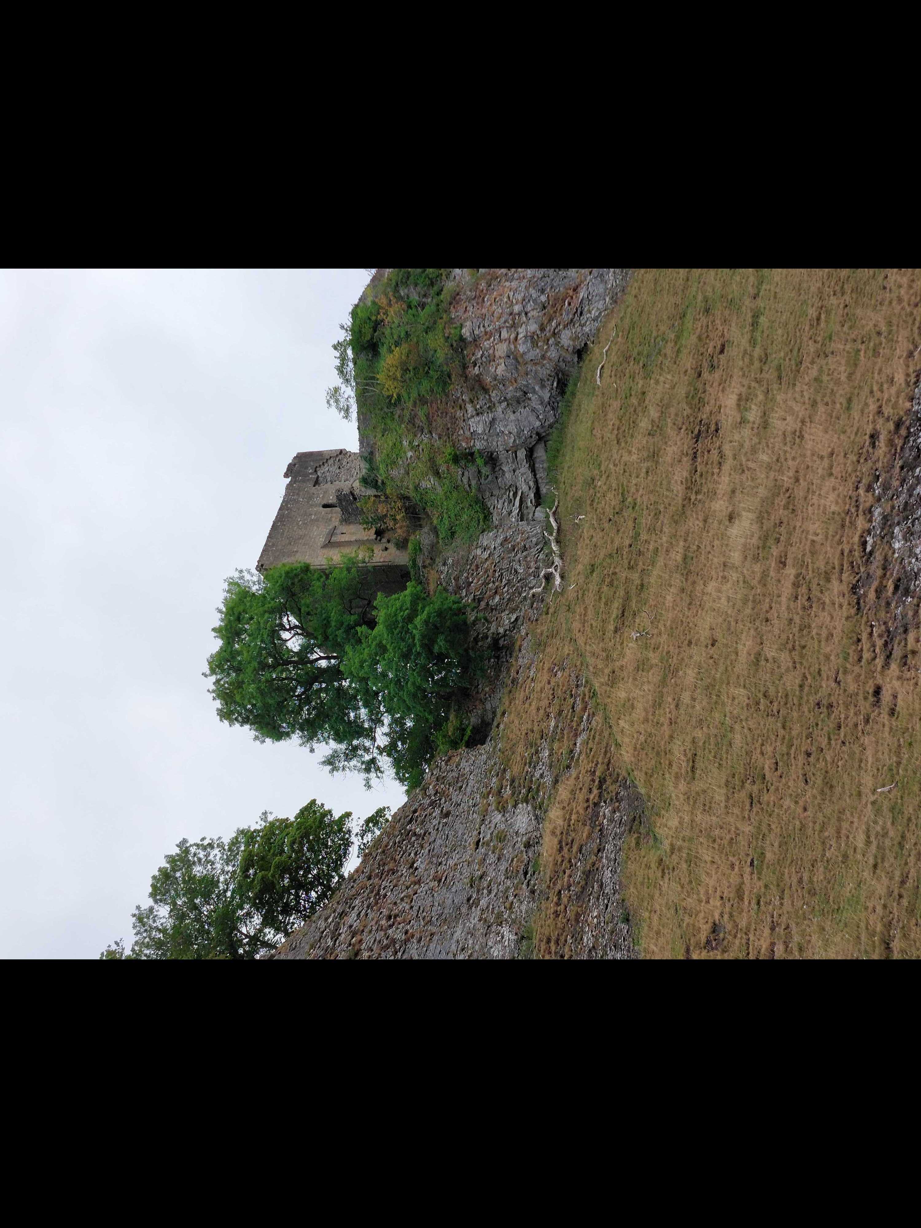
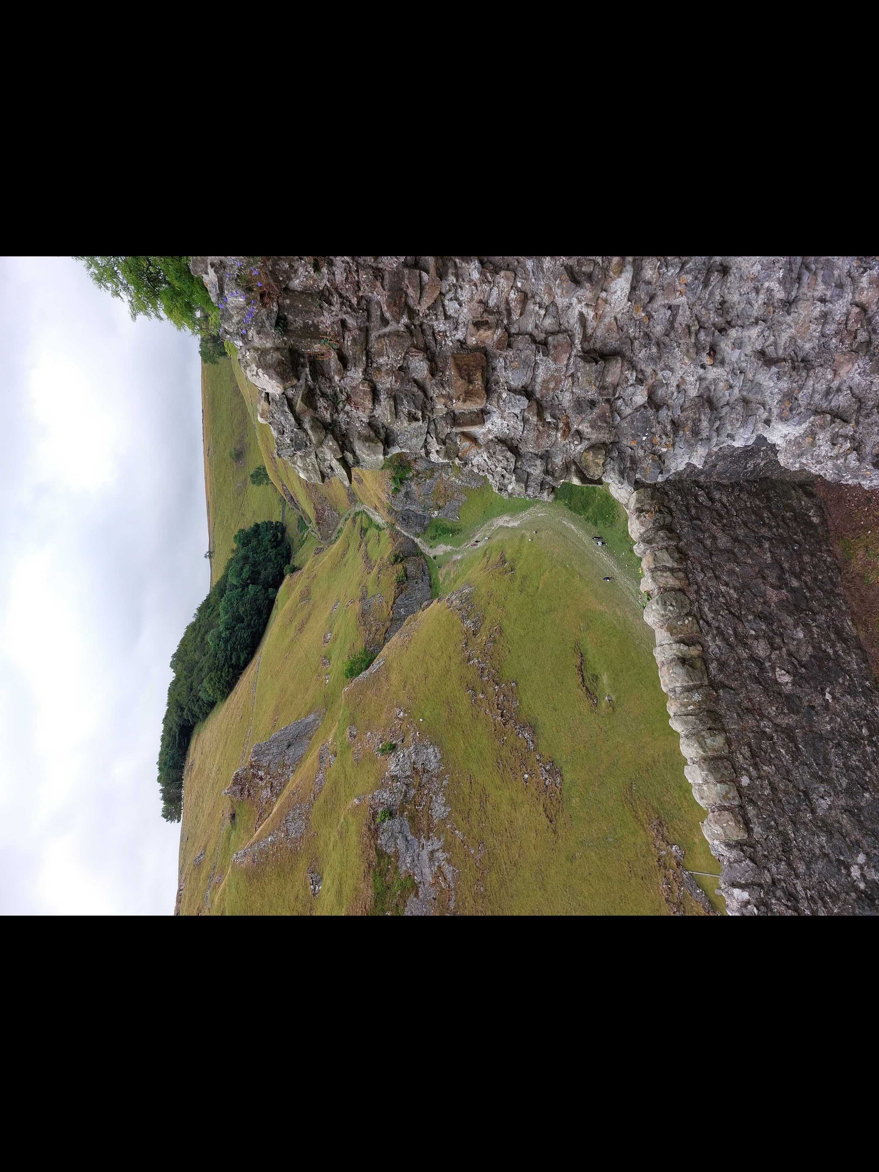
Following this path and then finally joining my originally planned route, I headed towards the canyon. The canyon is leading down to Castleston, and the name-giver to this village thrones above the canyon, keeping a good eye on everyone passing by. Inside the canyon, there are also many caves which you can find, while all of the bigger ones I found, where closed by a metal door. The sides of the canyon, which where not very steep, where filled with sheep, eating the bits of grass here and there.
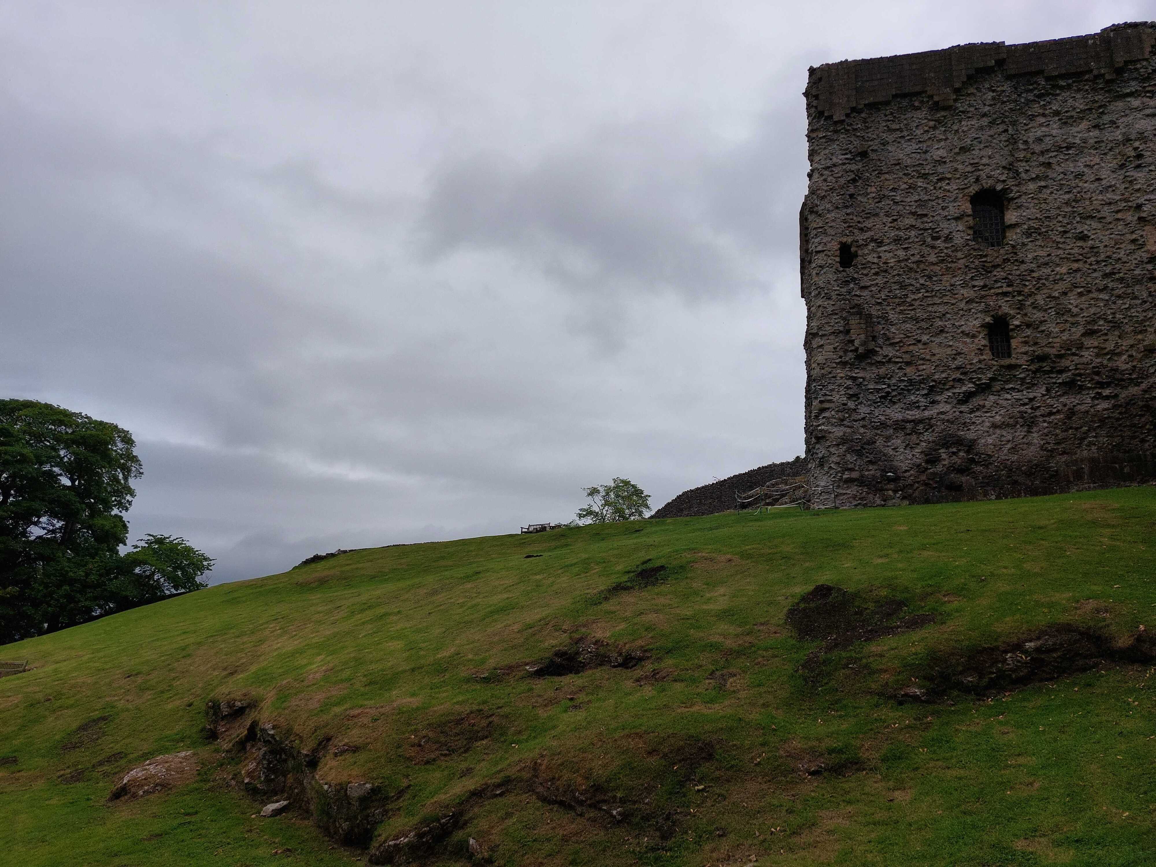
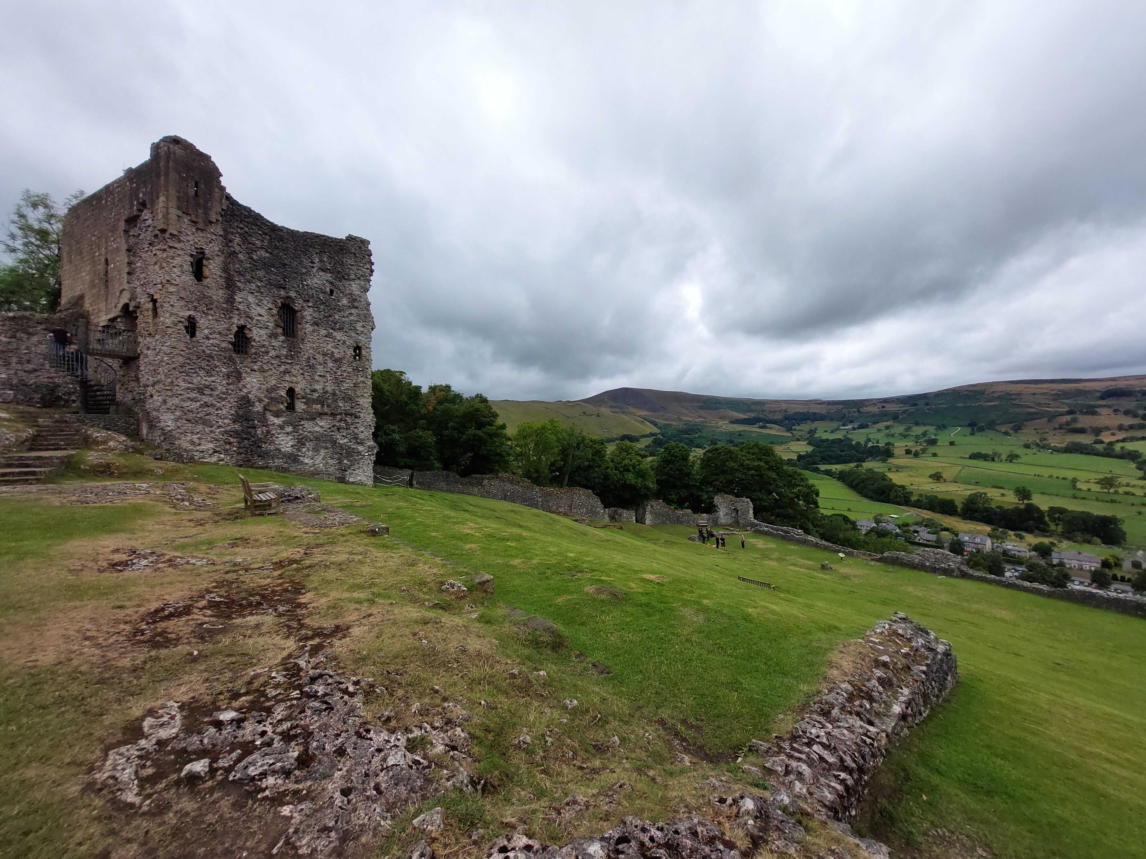
Having arrived in the village, I still had three hours until my train leaves, and I approximated that I would need around one to get back to Hope Village and 10 minutes to get from there to the railway. So I had enough time to visit the Peveril Castle. I paid the 8.50£ to the heritage fund and could climb the very steep hill on which the castle sits. You enter through what back then would have been the village-side entrance. Left over here is mostly half of an arc, that would have housed the doors. There was a secondary entrance which would have been used by horse carts on the other side, with a track over the ridge of the mountain. This was done as the hill would have been to steep for carts, while the longer track over the ridge would have been manageable. After entering the entrance, you stand in front of a large green field, which is inclined towards the south, dominated by the large keep, the main building next to the walls that is still mostly intact. The keep itself houses only two rooms on two levels, with the lower one probably used for storage, and the higher one for ceremonial duties and later as a court room. Ask for a guide book at the entrance, which explains the history of the castle, as far as it is known.
After spending some time in the castle I now was heading through Castleston back to Hope and then finally to the train station. Having arrived and stepped on the train, I barley could keep myself from falling asleep. Was not the most difficult hike, more like a very extended walk, but a very long and definitely a worth one.
| Start | Hope |
| Point of Interest | Black Tor (1h) |
| Point of Interest | Mam Tor (2h) |
| Point of Interest | Peveril Castle (4H) |
| End | Hope |