medium
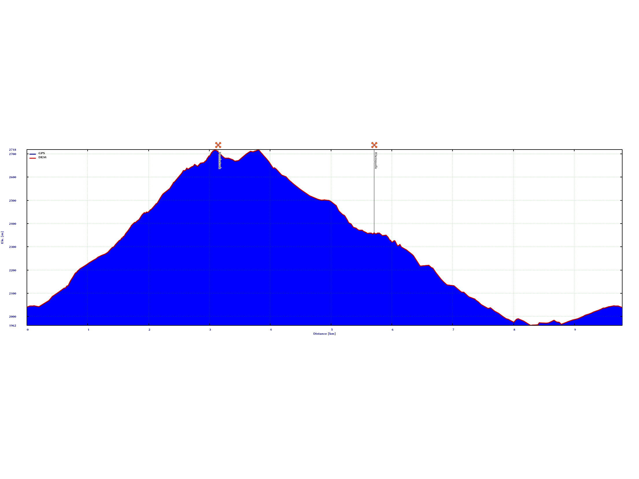
 | ↔ 10km | ↗ 800m | ↘ 800m | 🕑 6h | medium |
We started early in the morning with the train ride to Göschenen, on which, once you leave Zug behind, you pass through a rather stately mountain landscape from Zurich. Once in Göschenen, a train of the Matterhorn-Gotthard-Bahn takes you up to Andermatt. On this rather short stretch, a window seat is well worth it. On the left side in the direction of travel, at one point you have a view down into a gorge, crossed by roads and rails. It looks like Moria. On the right side you have a river, which in its turquoise color looks as if someone has tipped a little too much food coloring into the cast. The river shaped the stone into something that today creates beautiful flow patterns. The same goes for the pond that feeds the river, which you pass at the top of Andermatt, just before the stop. Turquoise and beautiful.
Andermatt itself is very touristy, many hotels, vacation apartments and winter residences with prices that make you stumble. The station itself looks very cute, surrounded by 5-story apartment buildings. However, you can already get a first view of the mountains from here, while waiting for the small train up to Oberalp Pass. It is worthwhile to get a seat on the left side in the direction of travel. At the beginning, the right side is entrusted with a somewhat better view into the valley, but this changes quickly after a serpentine. On the left one now has a fulminant view on an alpine panorama. A little later, on the right, one has again a view of the Oberalpsee, possibly with people having breakfast at the edge of the lake.
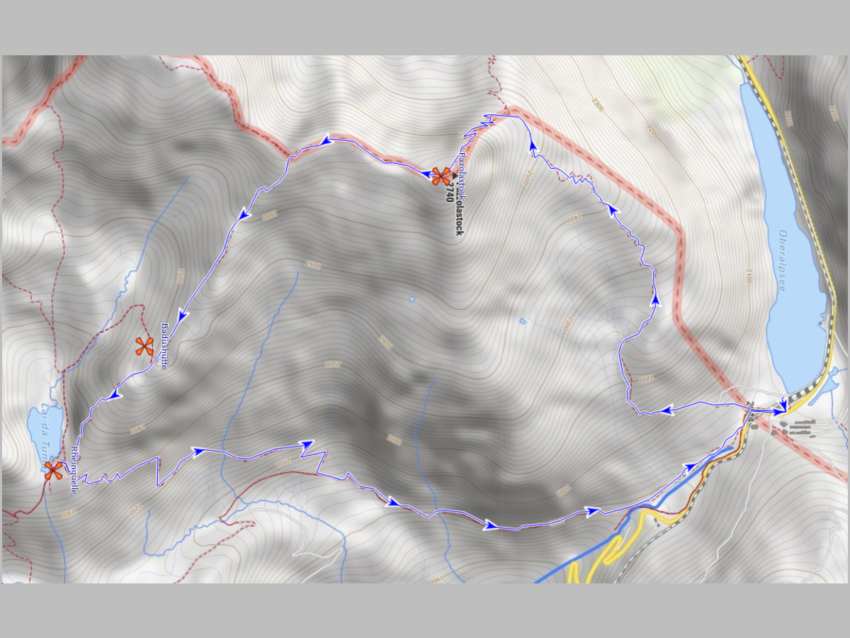
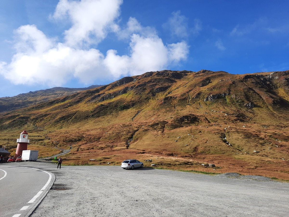
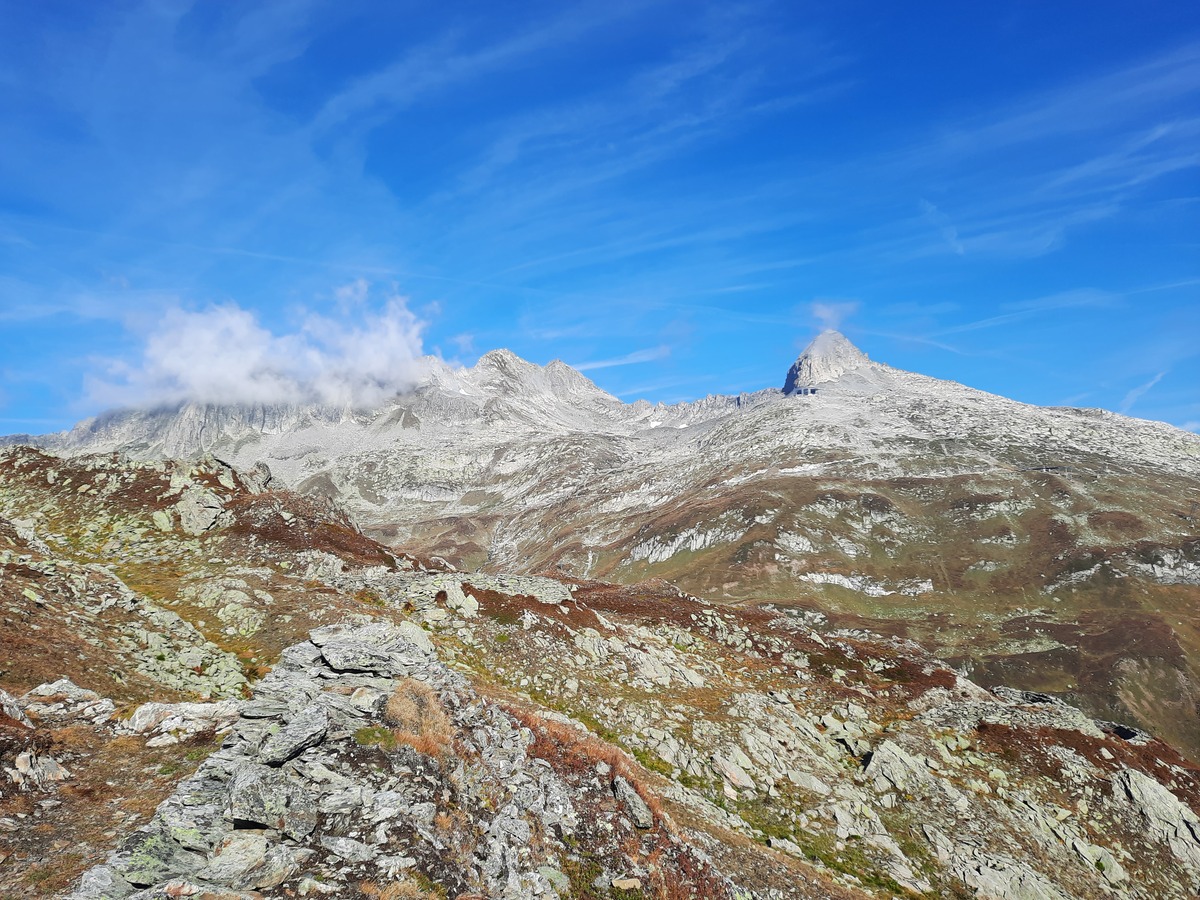
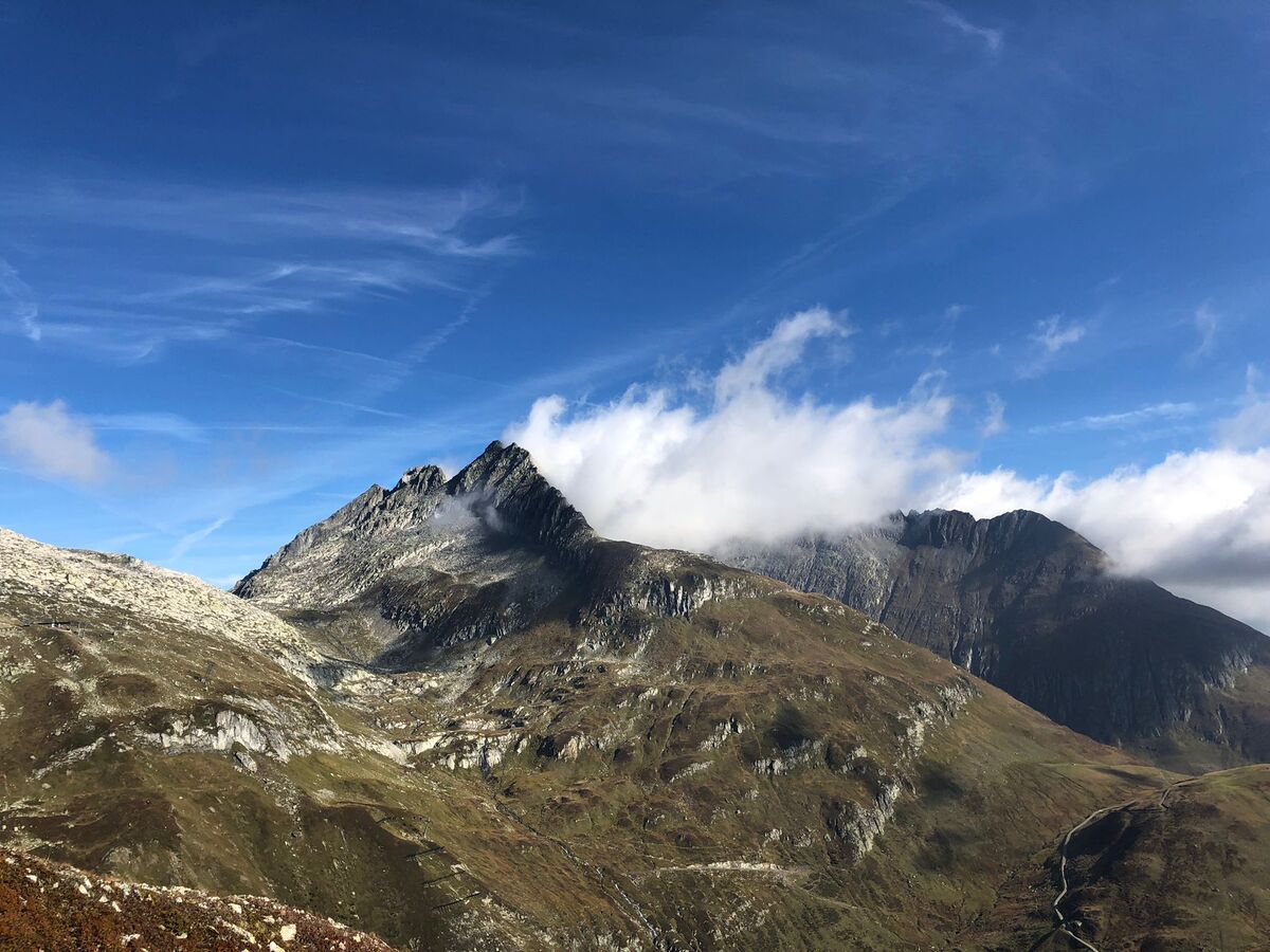
Arrived in Oberalpsee you can choose one of two routes. The first one is a bit flatter and easier, but we took the more demanding one. Demanding in this case means mainly free of giddiness and surefootedness - for pretty much every hobby hiker thus well doable. So leving the red lighthouse behind and then up the mountain. The entrance leads over mossy and with blueberry bushes covered paths, past small rivulets, in to a small plain. On the way you can already see the Pazolastock, which watches over you with its dark stone. Once on this small plain, you are greeted by a peak that slowly rises from behind the top of the plain. A fantastic sight.
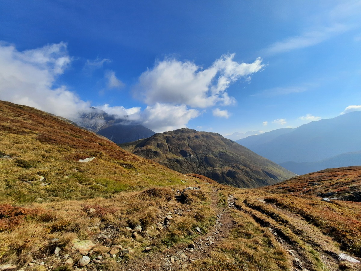
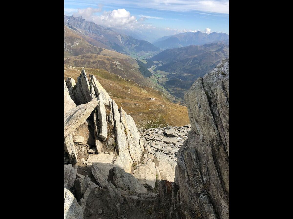
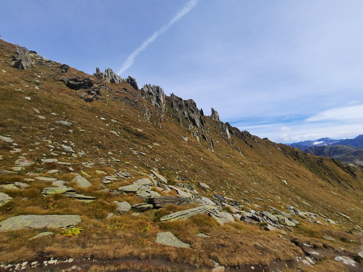
Now you make a small detour to the left, cross this plain to slowly dedicate yourself to the second part of the climb. However, it is really worth to spend some time in this plain, because you can discover a lot of wildlife here in small pools. The flora is also impressive to observe, from alpine cotton to many species of moss that fill the floodplains of the plateau and a myriad of alpine flowers. Also the view back into the valley or to the opposite mountain range is worth to interrupt the hunt for the summit for a short time. If you now climb a little further up the mountain, you will pass stone walls every now and then, which are probably old trenches. A little further up you can find the foundation walls of an old military barracks. From these walls you have a gigantic view on a lot of mountains. We were lucky that the sky was bright blue, some of the peaks had accumulated single clouds, a breathtaking view. From the old military barracks we now continue to the actual summit, the path winds in narrow serpentines along the mountain, past a small altar and a protruding boulder until we are finally on the last straight piece of path to the summit. At the exit of the last serpentine you can recharge your batteries with a small chocolate break and again enjoy the view, which this part of the Alps is all too willing to grant.
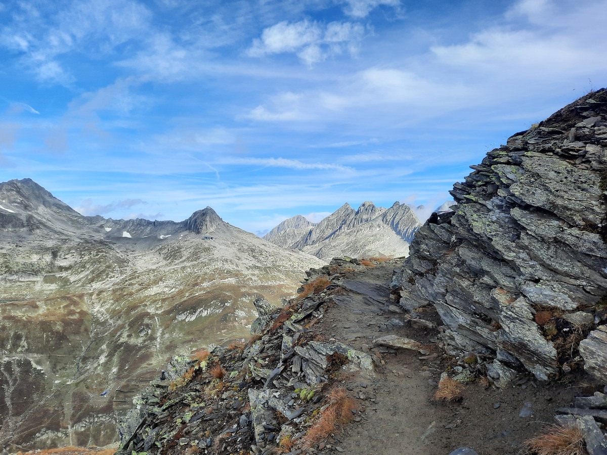
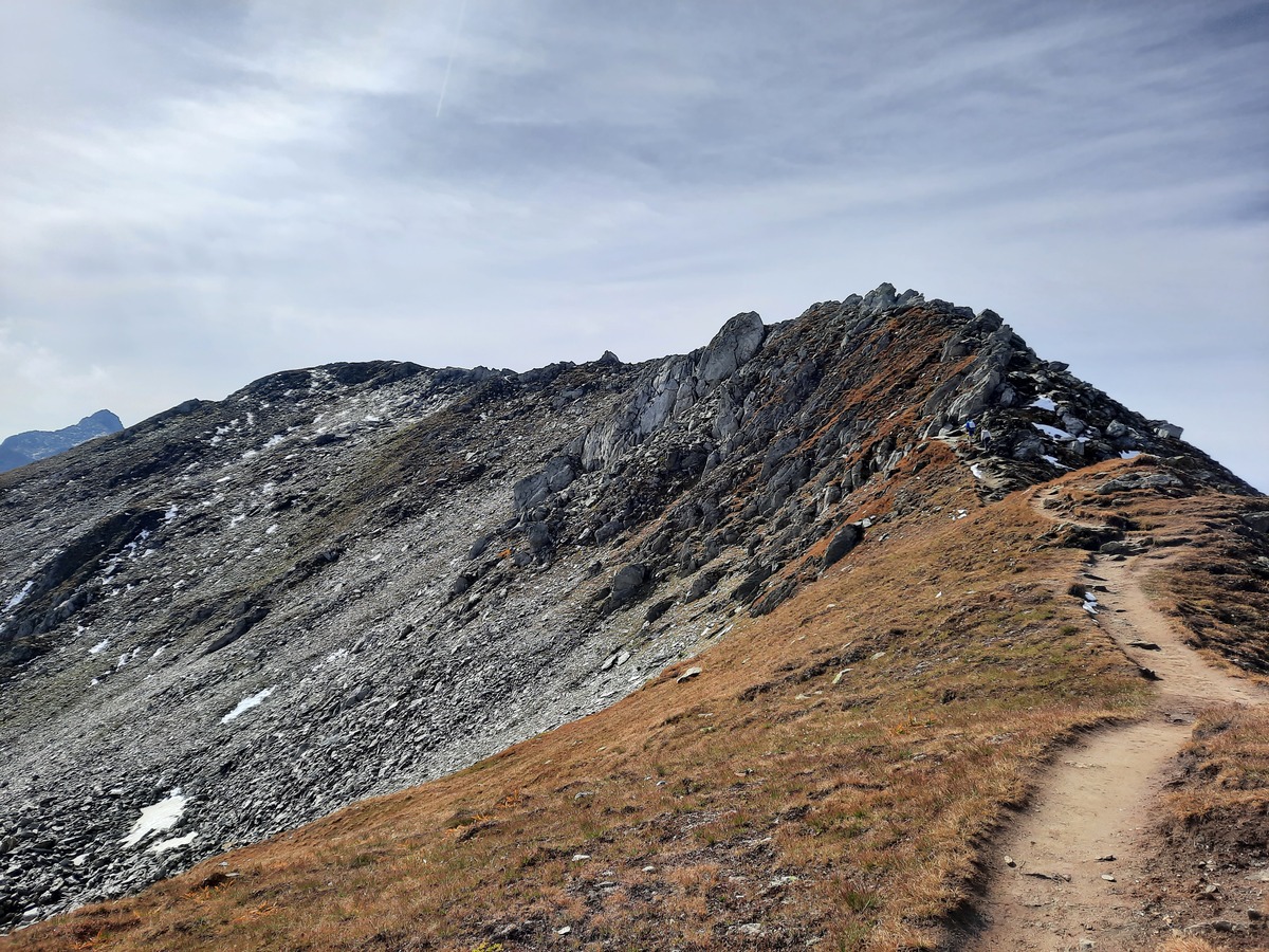
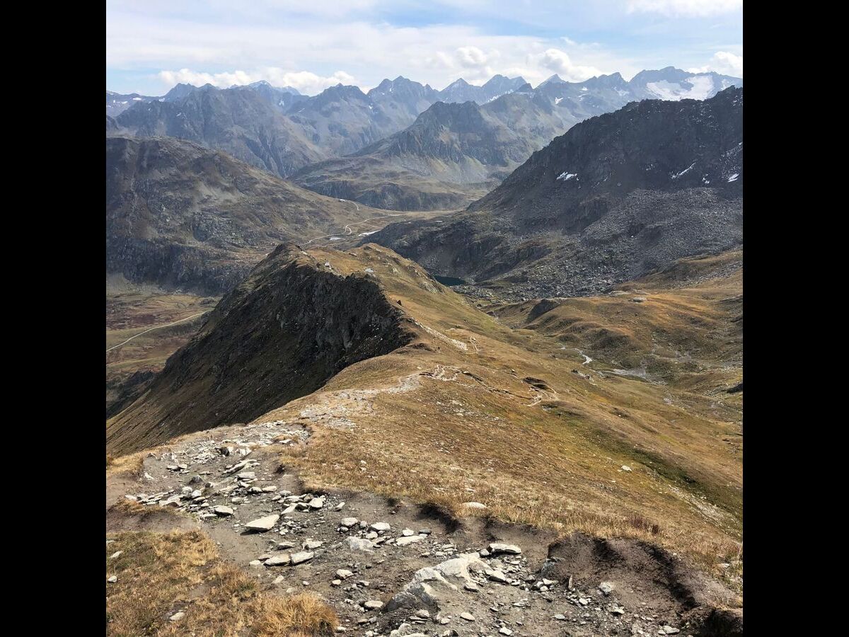
Now then the last few meters of altitude to the signpost that you already have in view. This sign post makes you think that you are already at the highest point of the Pazolastock, which actually is located about 10 meters higher on the left, along with the summit book, which is hidden in a cooking pot. Once you have immortalized yourself in the summit book, the rest of the way leads over a narrow path to the next summit. At the beginning, it goes quite steeply down, to then steeply rise up again through various boulders. Some climbing skill is needed here to maneuver through the boulders. We continued to have the best weather and thus after the little climb, enjoyed the view of the other side of the valley, which we celebrated with a few sandwiches and the obligatory summit egg.
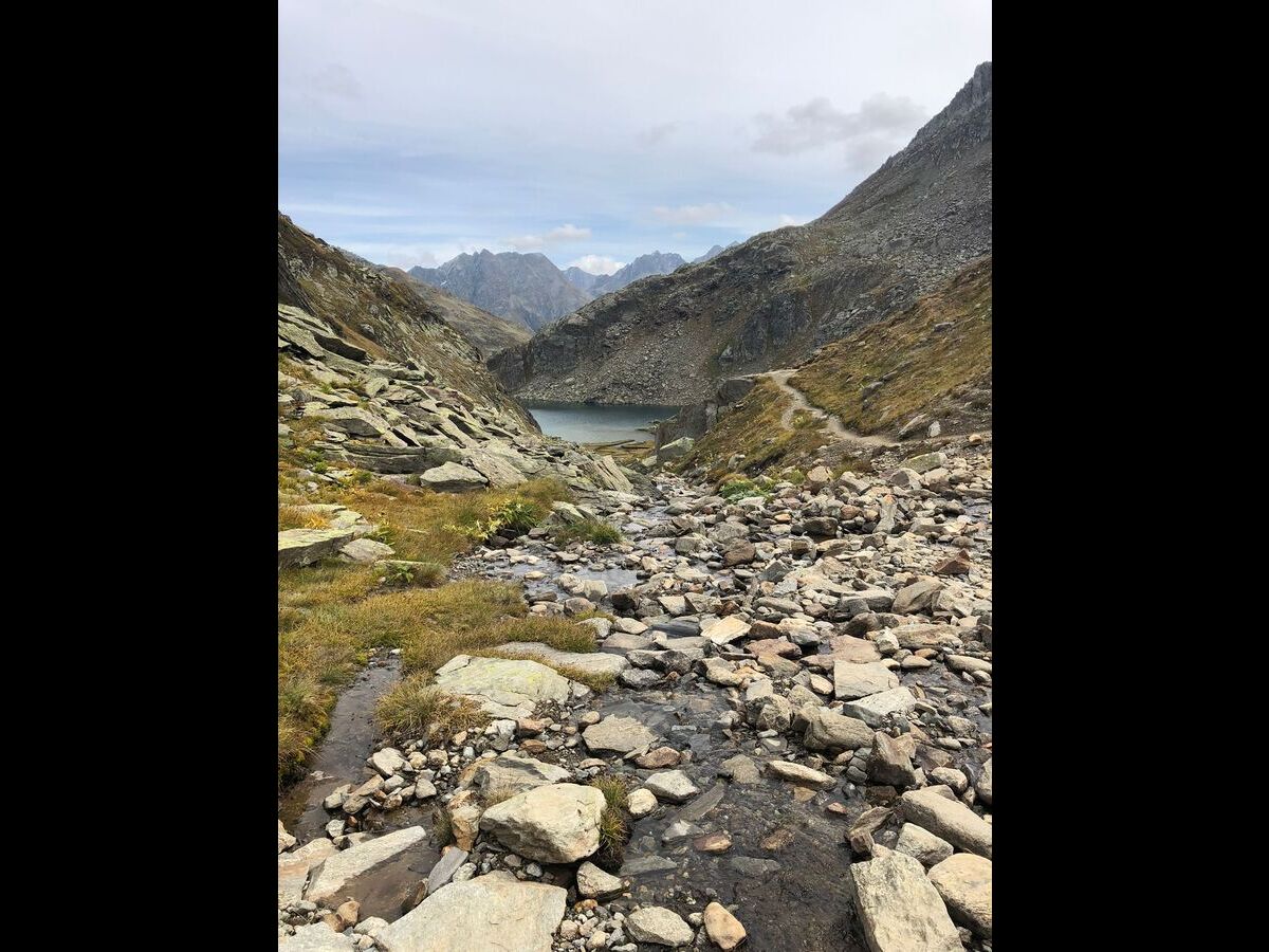
Now we continue our descent to the actual destination of the whole undertaking, Lake Toma, or Lai da Tuma in the local language, which is considered the source of the Rhine. In this descent we pass the Badushütte, which we leave unvisited after briefly considering whether we should treat ourselves to a small piece of cake here. Now a somewhat steeper descent to the lake itself, which could be seen for some time already. During the descent, it unfortunately became a bit cloudier, but this did not affect the impression of the lake. One climbs several times through small mountain streams that feed the lake. These are crisscrossed with stones and lined with rocks, which together make a beautiful picture. To the right you can see some debris avalanches, here you can make a small detour to admire the lake again from a little higher. At the lake itself it goes to the left, again climbing over some boulders to find, in this hiking direction somewhat hidden, the sign of the Rhine source. If you continue along this path, you will come to a small fork. Here you keep to the left to start the descent from the mountain.
The descent itself goes over many small switchbacks and boulders down into the valley. Unfortunately, at this point the view of this side of the valley was somewhat diminished by gray clouds, but it is still worth the descent to pause every now and then, not only to recharge your batteries, but also to let your gaze roam over the distant mountains. After the serpentines, the path runs parallel along the mountain itself, a nice stretch to drown out the background hum of the busy pass road with one or the other story, in our case that of the Egyptian princess who runs away from her marriage-mad father, to then find shelter as Guiletta in another kingdom.
Back at the Oberalp Pass, one has to be a bit careful with the train one gets on. The two depart quite promptly, and the rear train, which actually goes to Andermatt is hidden by the front one. So of course we got on the wrong one and got off at the next station, waited there for an hour and then set off again for Andermatt - this time in the right direction. We spent the waiting time watching some kids playing volleyball, who probably had the most beautiful view during their game that you can have in a country school with a volleyball court.
This hike is very rewarding, even though the initial climb is tough and the later ridge walk requires a head for heights and surefootedness. It is thus not intended for absolute beginners, but well doable for everyone else. The efforts are rewarded with an amazing view and with a clean and nice cool air, which frees the lungs once from all the city dirt.
| Start | Oberappass |
| Point of Interest | Pazolastock 3:00h |
| Point of Interest | Badushütte 4:00h |
| Point of Interest | Lai da Tuma / Rheinquelle 4:30 |
| End | Oberalppass |